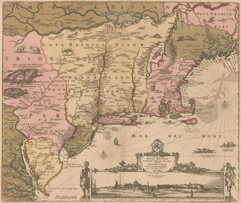
Novi Belgii Novæque Angliæ nec non partis Virginiæ tabula : multis in locis emendata
1684
(W 79°00ʹ00ʺ--W 68°40ʹ00ʺ/N 46°51ʹ00ʺ--N 37°00ʹ00ʺ).
A historical map depicts the region of New Netherland and New England, showing settlements, geographical features, and indigenous territories. A decorative cartouche at the bottom features a coat of arms and a vignette of a European settlement with ships. Relief shown pictorially. MAP HMC01.1216
Tags
You may like
Building a new visual wall from this artwork...