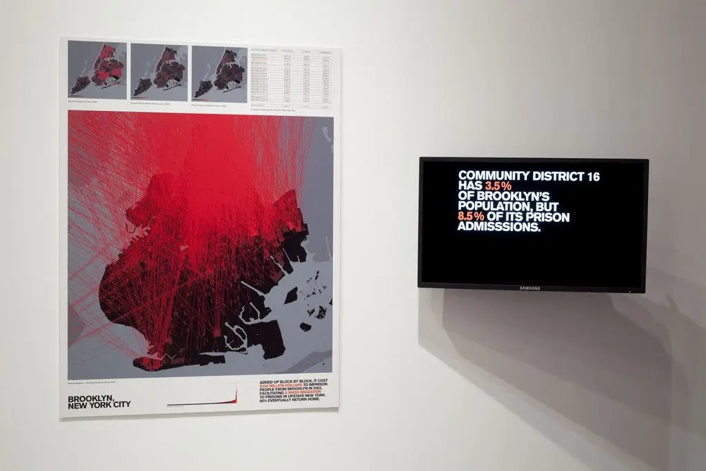
Architecture and Justice from the Million Dollar Blocks project
2006
ESRI ArcGIS (Geographic Information System) software
A large graphic displays a map of Brooklyn overlaid with dense red lines, suggesting movement or data points. To the right, a digital screen shows text about community statistics.
Tags
You may like
Building a new visual wall from this artwork...