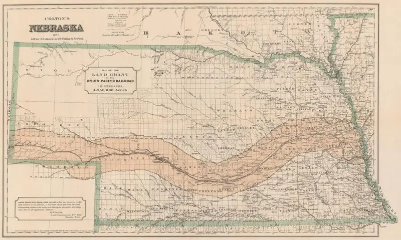
Colton's Nebraska : map of the land grant of the Union Pacific Railroad in Nebraska
Colton, G. Woolworth (George Woolworth), 1827-1901
1877
(W 104°05ʹ00ʺ--W 95°14ʹ00ʺ/N 43°31ʹ00ʺ--N 39°45ʹ00ʺ).
A map of Nebraska showing the land grant for the Union Pacific Railroad, detailing 4,250,000 acres. The map includes county lines, rivers, and towns. "Entered according to Act of Congress in the year 1875 by G.W. and C.B. Colton & Co. in the Office of the Librarian of Congress, at Washington." MAP HMC01.6532
Tags
You may like
Building a new visual wall from this artwork...