saved.works
tag
Tag
Cartography
Cartography is a browsable saved.works tag spanning 22 works by 14 artists across 9 institutions.
Artists under this tag
Hondius
4 works surfaced for this tag.
Unknown artist
4 works surfaced for this tag.
Jodocus Hondius
3 works surfaced for this tag.
Cram, George Franklin, 1841-1928
1 work surfaced for this tag.
Danckerts
1 work surfaced for this tag.
Froiseth, B. A. M. (Bernard Arnold Martin), 1839-1922
1 work surfaced for this tag.
Guillaume De L'Isle
1 work surfaced for this tag.
Jodocus Hondius (II)
1 work surfaced for this tag.
Museums under this tag
Princeton Digital PUL
8 works surfaced for this tag.
Library of Congress
4 works surfaced for this tag.
Kyushu National Museum
2 works surfaced for this tag.
Minneapolis Institute of Art
2 works surfaced for this tag.
Rijksmuseum
2 works surfaced for this tag.
Denver Art Museum
1 work surfaced for this tag.
Museum of New Zealand Te Papa Tongarewa
1 work surfaced for this tag.
New York Historical
1 work surfaced for this tag.
Works under this tag
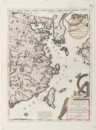
Map of Eastern China
Vincenzo Coronelli · Italy dated 1692
Kyushu National Museum · India-ink woodblock print on paper
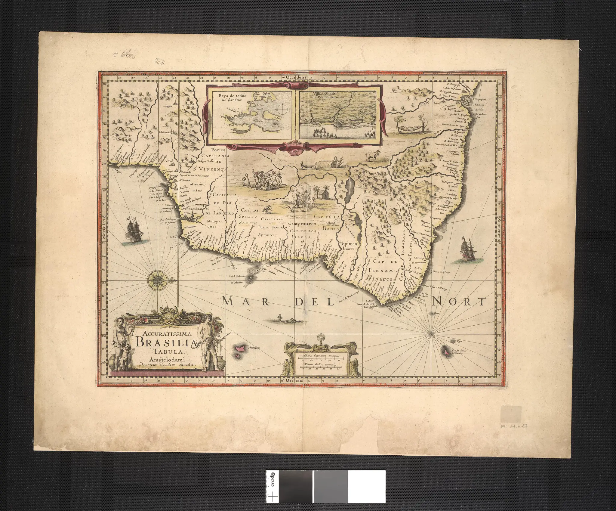
A Most Accurate Picture of Brazil.
Hondius · 1630-01-01
Library of Congress · map
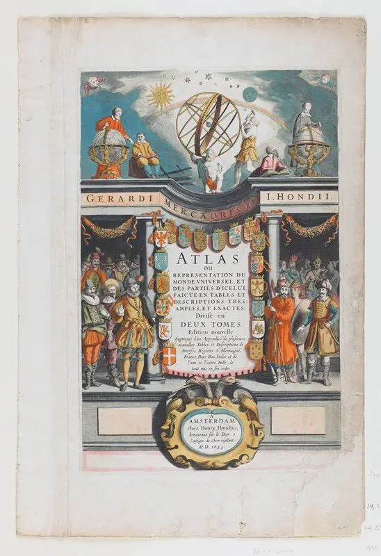
Dedication to Luoys de Bourbon, XIII. DVNOM, from Atlas
Jodocus Hondius · 1623
Minneapolis Institute of Art · Color engraving
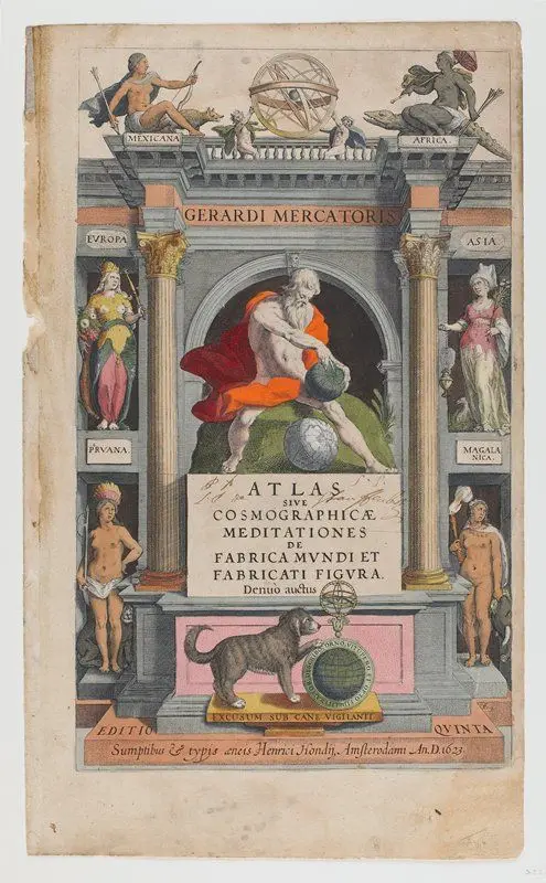
Frontispiece from Atlas
Jodocus Hondius · 1623
Minneapolis Institute of Art · Color engraving

Abyssinia, or the Empire of Prester John.
Hondius · 1619-01-01
Library of Congress · map
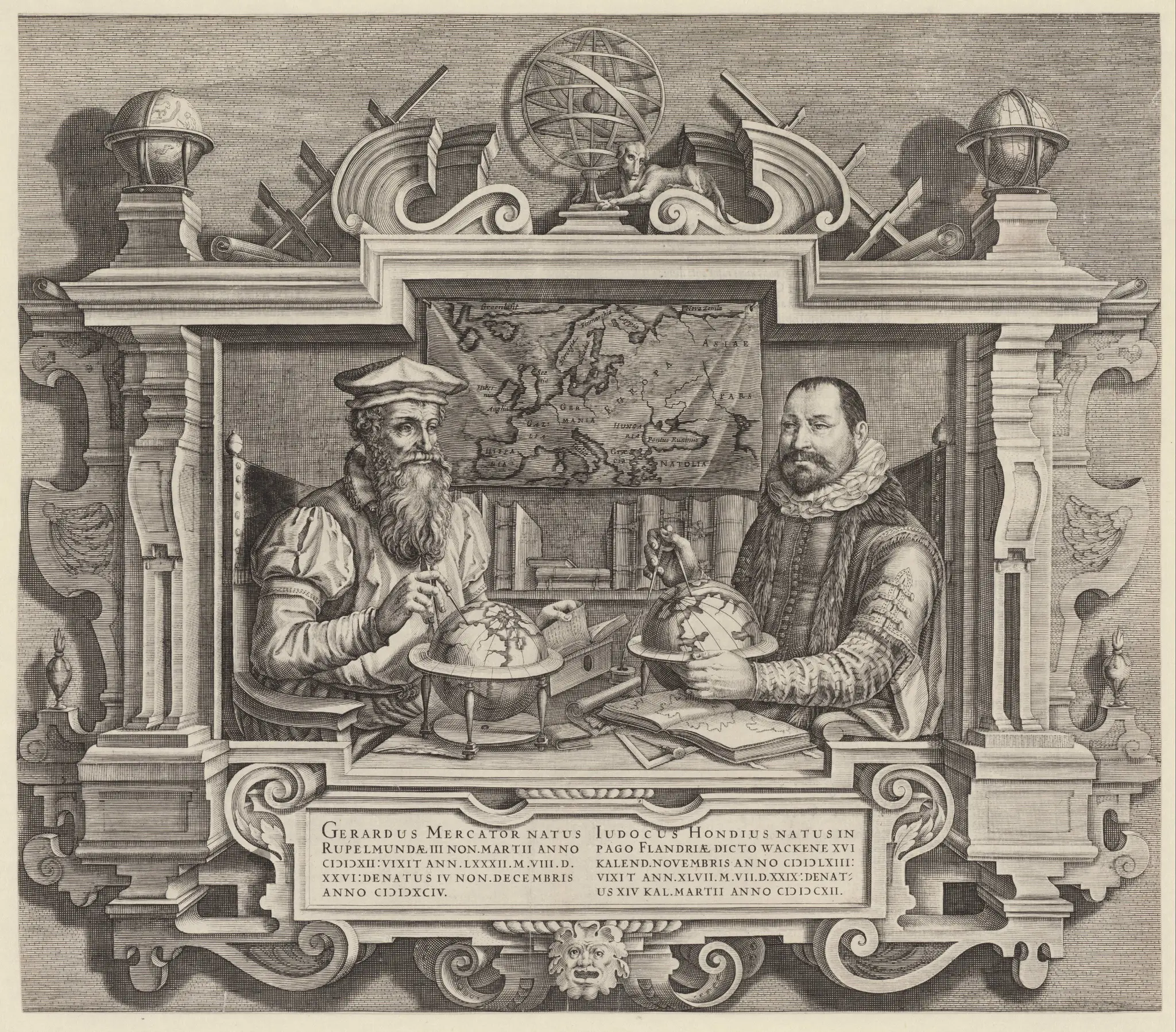
Portret van Jodocus Hondius en Gerard Mercator
Jodocus Hondius (II) · 1613
Rijksmuseum · gravure; boekdruk verso

Venezuela with the Southern Part of New Andalusia.
Hondius · 1612-01-01
Library of Congress · map

Fez and the Kingdom of Morocco.
Hondius · 1606-01-01
Library of Congress · map
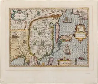
Map of China
Jodocus Hondius · Belgium dated 1606
Kyushu National Museum · Partially colored woodblock print on paper
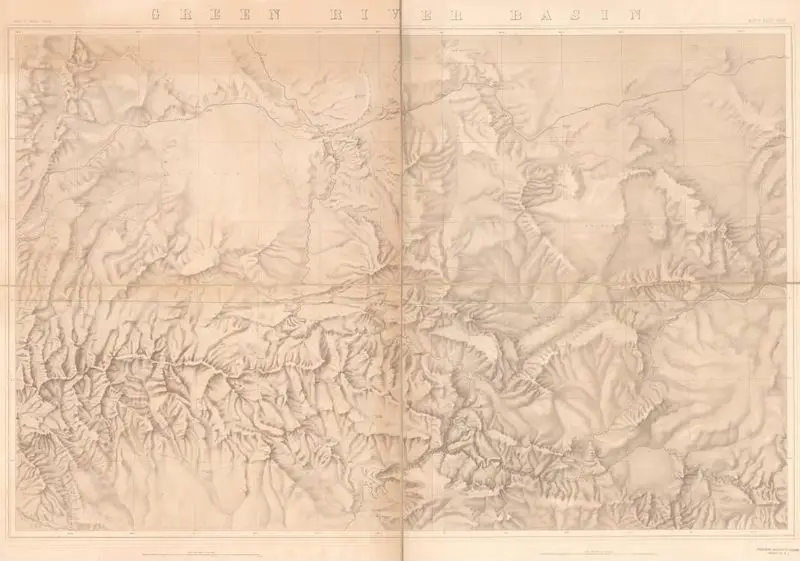
Green River Basin
United States. Geological Exploration of the Fortieth Parallel · 1876
Princeton Digital PUL · (W 110⁰44ʹ--W 107⁰34ʹ/N 41⁰50ʹ--N 40⁰17ʹ).
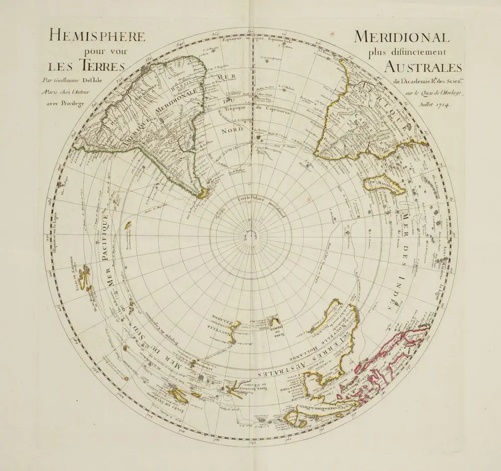
Hemisphere pour voir Les Terres/ Meridional plus distinctement Australes
Guillaume De L'Isle · 1714
Museum of New Zealand Te Papa Tongarewa · paper, ink
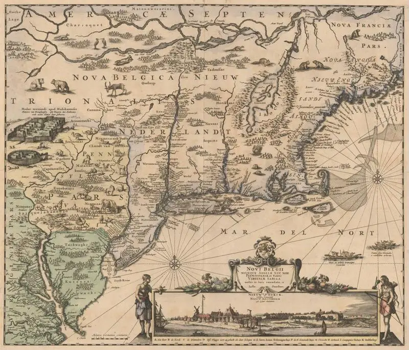
Novi Belgii, Novaeque Angliae nec non Pennsylvaniae et partis Virginiae tabula
Danckerts · 1683
Princeton Digital PUL · (W 81°40ʹ00ʺ--W 66°40ʹ00ʺ/N 46°10ʹ00ʺ--N 37°00ʹ00ʺ).
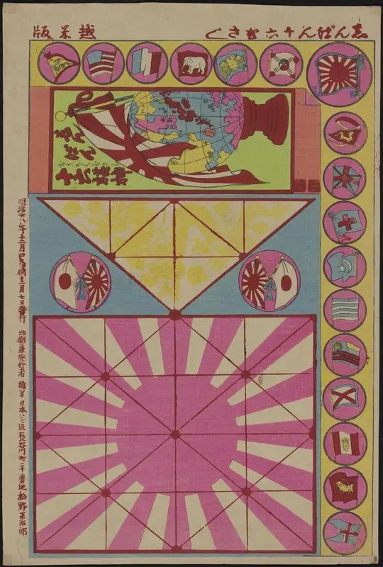
Shinpan juroku musashi (New edition, a board game with 16 flags).
Unknown artist · 1895
Princeton Digital PUL · 1 sheet : color ; 26 x 37…

Railroad and county map of Texas
Cram, George Franklin, 1841-1928 · 1888
Princeton Digital PUL · (W 106°38ʹ00ʺ--W 93°30ʹ00ʺ/N 34°00ʹ00ʺ--N 25°50ʹ00ʺ).
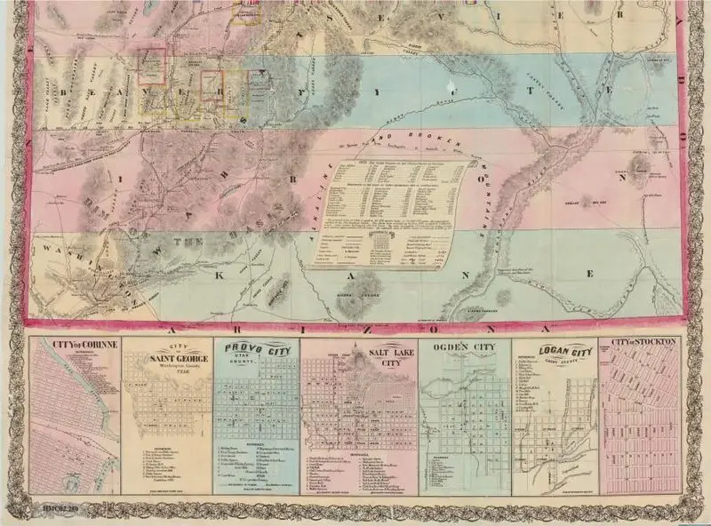
Froiseth's new sectional & mineral map of Utah : compiled from the latest U.S. government surveys and other authentic sources : exhibiting the sections, fractional sections, counties, cities, towns, settlements, mines, railroads and other internal improvements
Froiseth, B. A. M. (Bernard Arnold Martin), 1839-1922 · 1871
Princeton Digital PUL · (W 114°03ʹ00ʺ--W 109°02ʹ00ʺ/N 42°00ʹ00ʺ--N 37°00ʹ00ʺ).
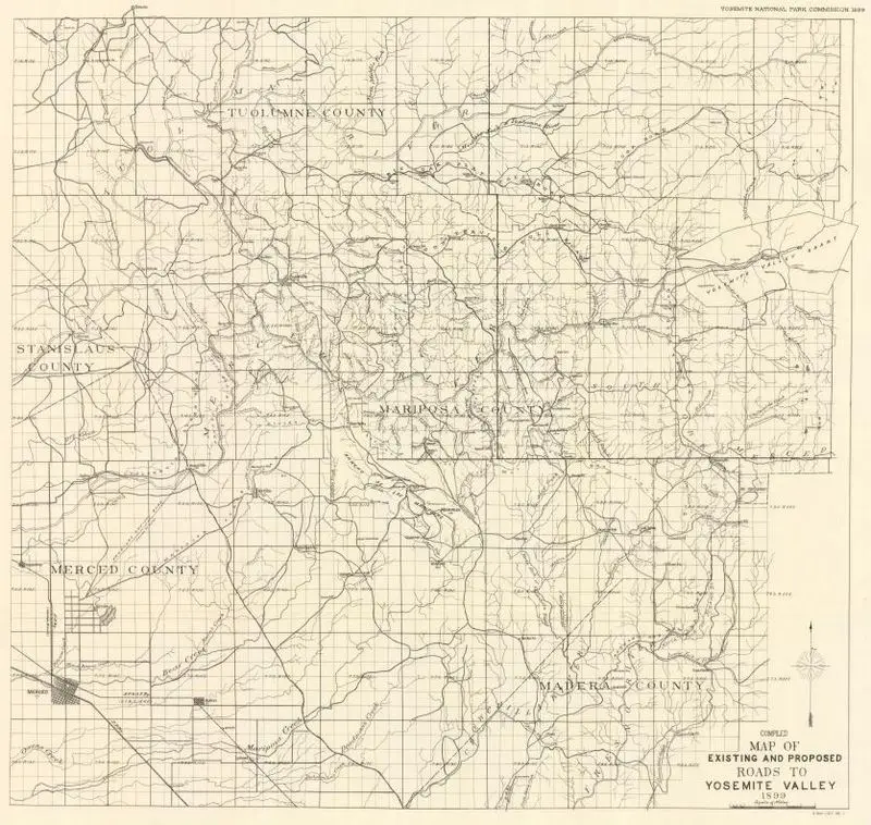
Compiled map of existing and proposed roads to Yosemite Valley, 1899
Unknown artist · 1899
Princeton Digital PUL · (W 120°32ʹ00ʺ--W 119°18ʹ00ʺ/N 38°00ʹ00ʺ--N 37°11ʹ00ʺ)
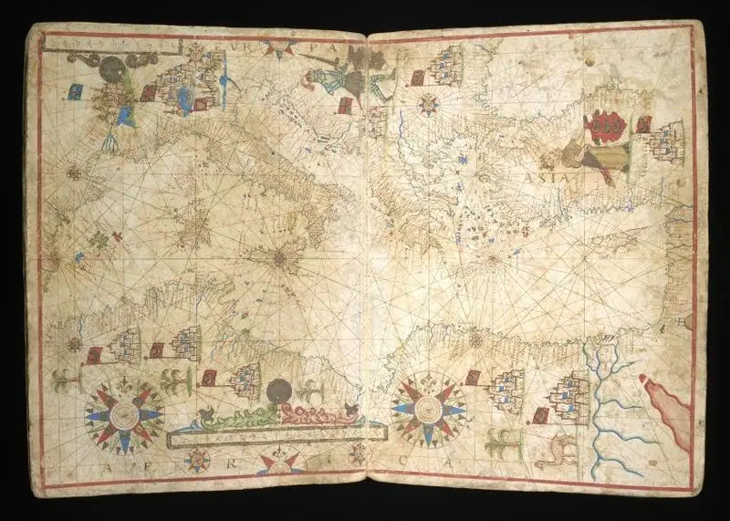
Portolan charts and a manuscript map
Unknown artist · 1642
Princeton Digital PUL · 3 leaves (folded) : parchment ; 380 x…
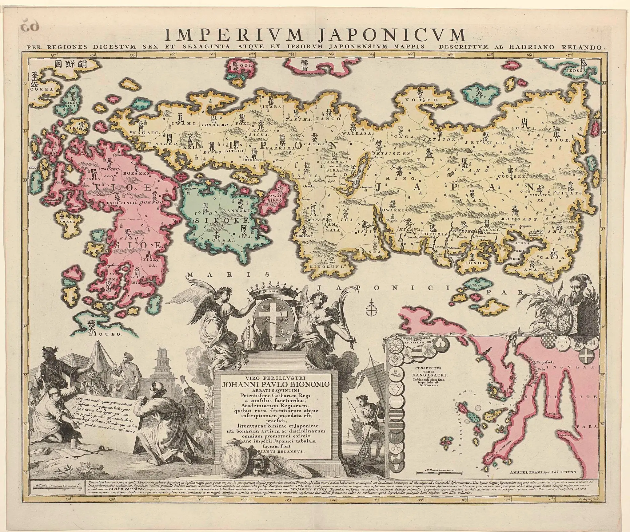
Kaart van Japan met bijkaart van Nagasaki
Unknown artist · 1737 - 1750
Rijksmuseum · Kaart van Japan, met o.a. Imari, Arita, Nagasaki, Osaka en…
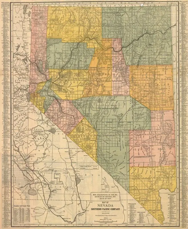
Map of Nevada
Rand McNally and Company · 1924
Princeton Digital PUL · (W 120°58ʹ00ʺ--W 113°50ʹ00ʺ/N 42°10ʹ00ʺ--N 35°00ʹ00ʺ).
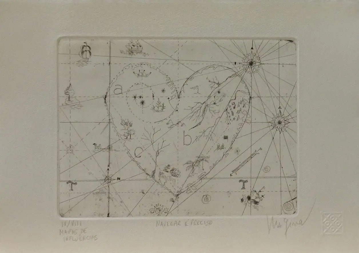
Navegar é preciso
Maria Pinto · 2009
Pinacoteca de Sao Paulo · água-forte sobre papel
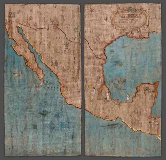
Mapa for Malinche and our Stolen Sisters Dedicated to Missing and Murdered Indigenous Women (MMIW) and families
Sandy Rodriguez · 2021
Denver Art Museum · Amate paper, 24K gold, Maya blue, red ochre…

Escape map
United States Coast and Geodetic Survey · 1944
New York Historical · Silk