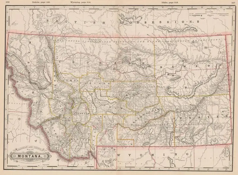
Railroad and county map of Montana
Cram, George Franklin, 1841-1928
1888
(W 116°10ʹ00ʺ--W 103°45ʹ00ʺ/N 50°15ʹ00ʺ--N 44°21ʹ00ʺ).
A historical map of Montana, detailing railroads and county boundaries. The map includes topographical features like rivers and mountains, as well as labels for cities and territories. Relief shown by hachures. MAP HMC01.6396
Tags
You may like
Building a new visual wall from this artwork...