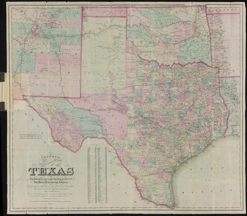
Colton's new map of the State of Texas, compiled from J. De Cordova's large map
Colton, G. Woolworth (George Woolworth), 1827-1901
1864
1 map : col. ; 41 x 62 cm.
A colored map of Texas and surrounding territories, showing state and territorial boundaries, cities, rivers, and topography. The map is detailed with text labels and a legend. Insets: Plan of the northern part of Texas. -- Plan of Galveston Bay. -- Plan of Sabine Lake. WA A-North 25, drawer 1 4936161
Tags
You may like
Building a new visual wall from this artwork...