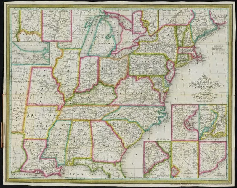
Mitchell's traveller's guide through the United States : containing the principal cities, towns, &c., alphabetically arranged : together with the stage, steam-boat, canal, and railroad routes, with the distances, in miles, from place to place : illustrated by an accurate map of the United States
Mitchell, S. Augustus (Samuel Augustus), 1792-1868
1838
78 p. : col. map (folded) ; 14 cm.
A colored map of the United States from 1838, showing state boundaries, cities, and geographical features. Insets provide detailed views of specific regions. A colored map of the United States from 1838, showing state boundaries, cities, and geographical features. Insets provide detailed views of specific regions. WA D-Alcove 33, drawer 10 4937139
Tags
You may like
Building a new visual wall from this artwork...