saved.works
tag
Tag
Inset Maps
Inset Maps is a browsable saved.works tag spanning 2 works by 2 artists across 1 institution.
Artists under this tag
Museums under this tag
Works under this tag
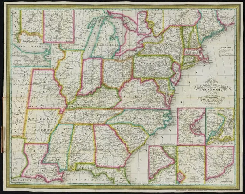
Mitchell's traveller's guide through the United States : containing the principal cities, towns, &c., alphabetically arranged : together with the stage, steam-boat, canal, and railroad routes, with the distances, in miles, from place to place : illustrated by an accurate map of the United States
Mitchell, S. Augustus (Samuel Augustus), 1792-1868 · 1838
Princeton Digital PUL · 78 p. : col. map (folded) ; 14…
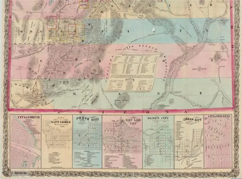
Froiseth's new sectional & mineral map of Utah : compiled from the latest U.S. government surveys and other authentic sources : exhibiting the sections, fractional sections, counties, cities, towns, settlements, mines, railroads and other internal improvements
Froiseth, B. A. M. (Bernard Arnold Martin), 1839-1922 · 1871
Princeton Digital PUL · (W 114°03ʹ00ʺ--W 109°02ʹ00ʺ/N 42°00ʹ00ʺ--N 37°00ʹ00ʺ).