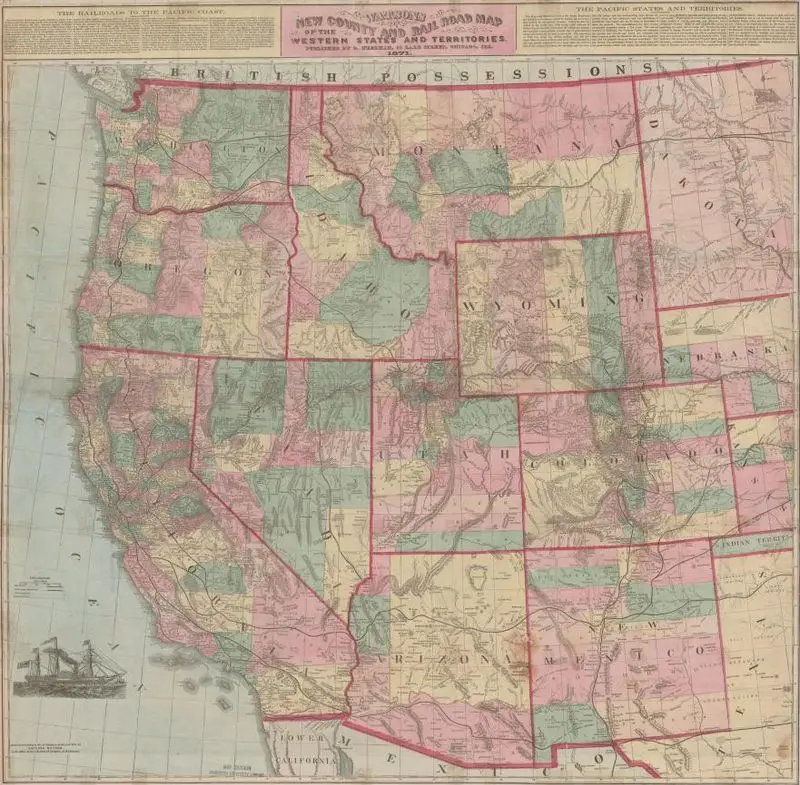
Watsons new county and railroad map of the western states and territories
1871
(W 128°00ʹ00ʺ--W 97°15ʹ00ʺ/N 50°00ʹ00ʺ--N 30°30ʹ00ʺ).
A historical map of the western United States and territories, detailing counties and railroads. The map features a pastel color palette and includes a small illustration of a sailing ship in the lower left corner. Relief shown by hachures and spot heights. MAP HMC01.1157
Tags
You may like
Building a new visual wall from this artwork...