saved.works
tag
Tag
Counties
Counties is a browsable saved.works tag spanning 2 works by 2 artists across 1 institution.
Artists under this tag
Museums under this tag
Works under this tag
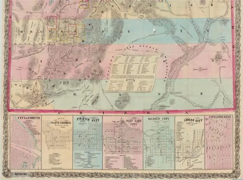
Froiseth's new sectional & mineral map of Utah : compiled from the latest U.S. government surveys and other authentic sources : exhibiting the sections, fractional sections, counties, cities, towns, settlements, mines, railroads and other internal improvements
Froiseth, B. A. M. (Bernard Arnold Martin), 1839-1922 · 1871
Princeton Digital PUL · (W 114°03ʹ00ʺ--W 109°02ʹ00ʺ/N 42°00ʹ00ʺ--N 37°00ʹ00ʺ).
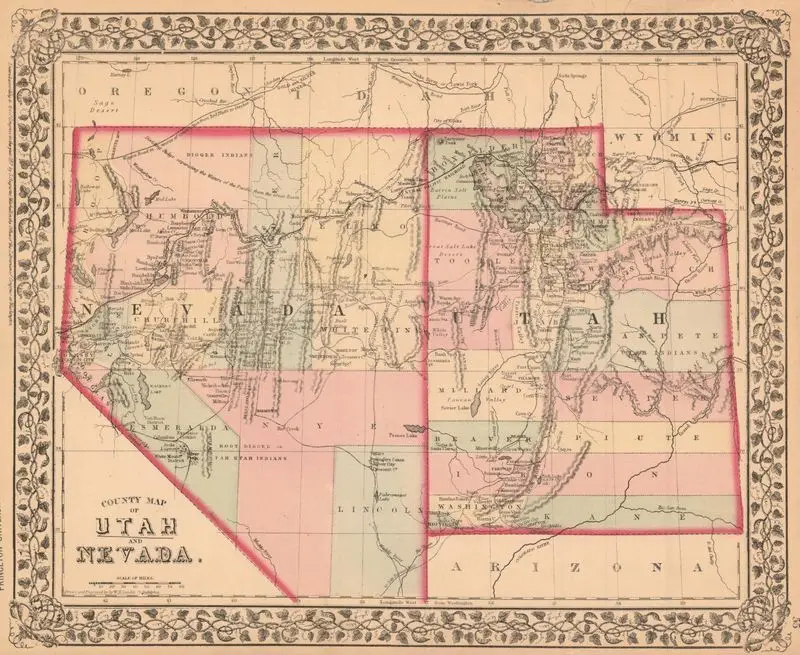
County map of Utah and Nevada
Gamble, W. H. (William H.) · 1870
Princeton Digital PUL · (W 120°15ʹ00ʺ--W 108°40ʹ00ʺ/N 42°30ʹ00ʺ--N 36°15ʹ00ʺ).