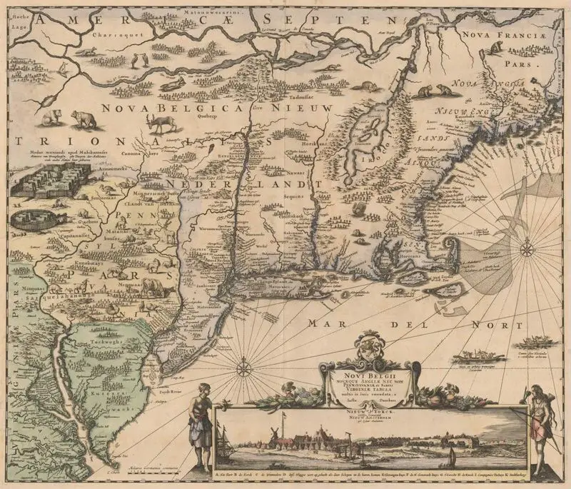
Novi Belgii, Novaeque Angliae nec non Pennsylvaniae et partis Virginiae tabula
1683
(W 81°40ʹ00ʺ--W 66°40ʹ00ʺ/N 46°10ʹ00ʺ--N 37°00ʹ00ʺ).
This is a historical map of North America, specifically detailing the regions of Nova Belgica, Nova Anglia, Pennsylvania, and parts of Virginia. It includes topographical features, settlements, and illustrations of wildlife and human figures. This is a historical map of North America, specifically detailing the regions of Nova Belgica, Nova Anglia, Pennsylvania, and parts of Virginia. It includes topographical features, settlements, and illustrations of wildlife and human figures. Described as the second issue of the "Jansson-Visscher series," with Philadelphia added to place names on map. Cf. Campbell, cited below. MAP HMC01.1207
Tags
You may like
Building a new visual wall from this artwork...