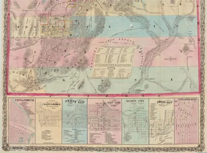
Froiseth's new sectional & mineral map of Utah : compiled from the latest U.S. government surveys and other authentic sources : exhibiting the sections, fractional sections, counties, cities, towns, settlements, mines, railroads and other internal improvements
Froiseth, B. A. M. (Bernard Arnold Martin), 1839-1922
1871
(W 114°03ʹ00ʺ--W 109°02ʹ00ʺ/N 42°00ʹ00ʺ--N 37°00ʹ00ʺ).
A historical map of Utah, featuring topographical details, county divisions, and inset city plans. The map is divided into colored sections representing different regions and includes a table of information. A historical map of Utah, featuring topographical details, county divisions, and inset city plans. The map is divided into colored sections representing different regions and includes a table of information. In cover. MAP HMC02.259
Tags
You may like
Building a new visual wall from this artwork...