saved.works
tag
Tag
Topography
Topography is a browsable saved.works tag spanning 7 works by 7 artists across 2 institutions.
Artists under this tag
Burr, David H., 1803-1875
1 work surfaced for this tag.
Freyhold, Edward
1 work surfaced for this tag.
Froiseth, B. A. M. (Bernard Arnold Martin), 1839-1922
1 work surfaced for this tag.
United States Coast and Geodetic Survey
1 work surfaced for this tag.
United States. Geological Exploration of the Fortieth Parallel
1 work surfaced for this tag.
Unknown artist
1 work surfaced for this tag.
Whistler, James McNeill, 1834-1903
1 work surfaced for this tag.
Museums under this tag
Works under this tag
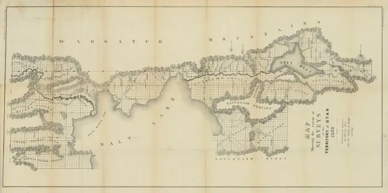
Map showing the extent of surveys in the Territory of Utah, 1856
Burr, David H., 1803-1875 · 1856
Princeton Digital PUL · (W 112°30ʹ00ʺ--W 111°30ʹ00ʺ/N 42°02ʹ00ʺ--N 39°49ʹ00ʺ).
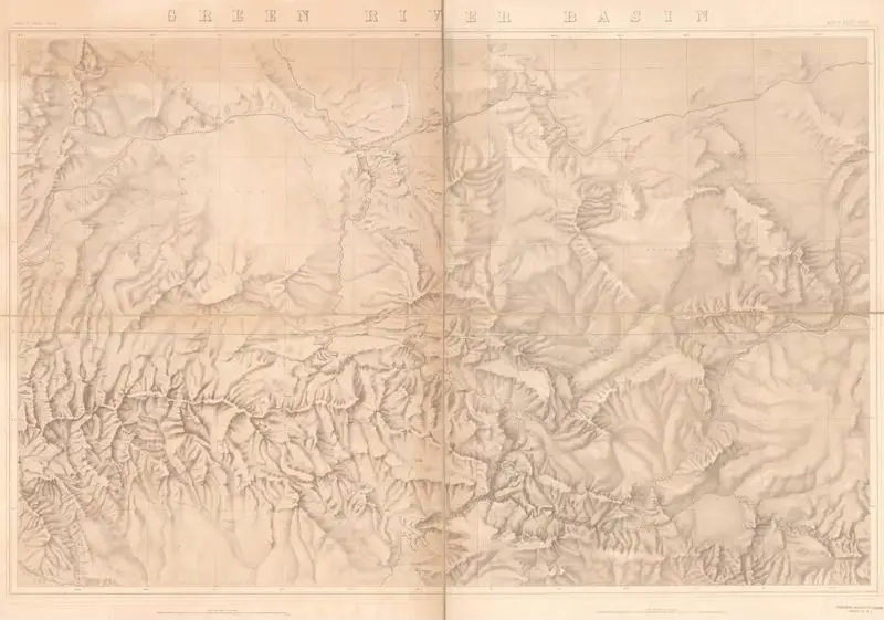
Green River Basin
United States. Geological Exploration of the Fortieth Parallel · 1876
Princeton Digital PUL · (W 110⁰44ʹ--W 107⁰34ʹ/N 41⁰50ʹ--N 40⁰17ʹ).
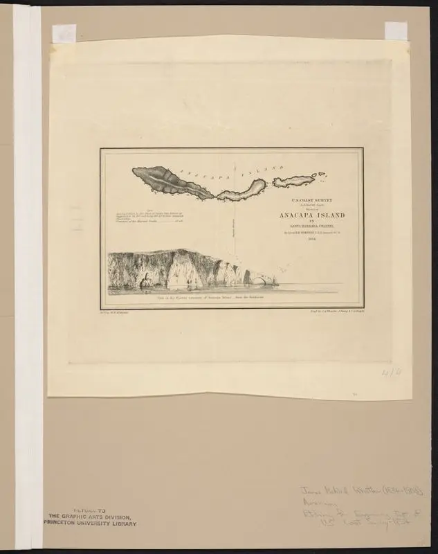
Sketch of Anacapa Island.
Whistler, James McNeill, 1834-1903 · 1854
Princeton Digital PUL · 1 item
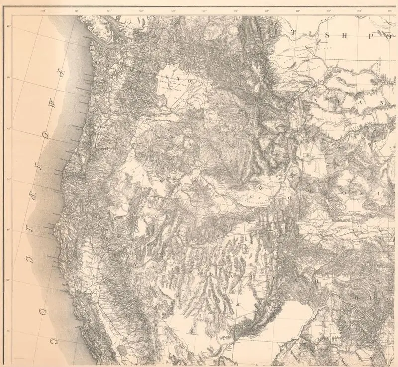
Territory of the United States from the Mississippi River to the Pacific Ocean; originally prepared to accompany the reports of the explorations for a Pacific Railroad route
Freyhold, Edward · 1873
Princeton Digital PUL · 1 map in 4 segments 107 x 118…
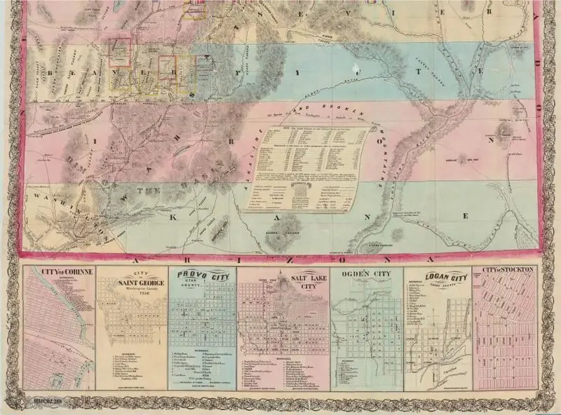
Froiseth's new sectional & mineral map of Utah : compiled from the latest U.S. government surveys and other authentic sources : exhibiting the sections, fractional sections, counties, cities, towns, settlements, mines, railroads and other internal improvements
Froiseth, B. A. M. (Bernard Arnold Martin), 1839-1922 · 1871
Princeton Digital PUL · (W 114°03ʹ00ʺ--W 109°02ʹ00ʺ/N 42°00ʹ00ʺ--N 37°00ʹ00ʺ).
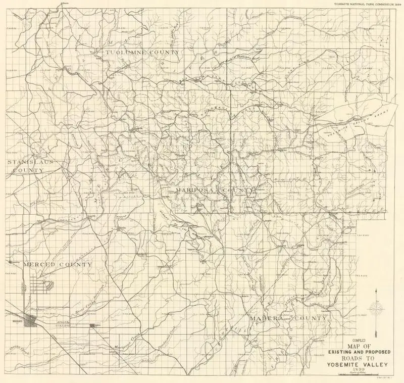
Compiled map of existing and proposed roads to Yosemite Valley, 1899
Unknown artist · 1899
Princeton Digital PUL · (W 120°32ʹ00ʺ--W 119°18ʹ00ʺ/N 38°00ʹ00ʺ--N 37°11ʹ00ʺ)

Escape map
United States Coast and Geodetic Survey · 1944
New York Historical · Silk