saved.works
tag
Tag
Maps
Maps is a browsable saved.works tag spanning 21 works by 15 artists across 3 institutions.
Artists under this tag
Unknown artist
5 works surfaced for this tag.
Colton, G. Woolworth (George Woolworth), 1827-1901
2 works surfaced for this tag.
Cram, George Franklin, 1841-1928
2 works surfaced for this tag.
C. Blake, active 1825–1826
1 work surfaced for this tag.
Farnham, Thomas Jefferson, 1804-1848
1 work surfaced for this tag.
G.W. & C.B. Colton & Co.
1 work surfaced for this tag.
Genthe
1 work surfaced for this tag.
Hondius
1 work surfaced for this tag.
Museums under this tag
Works under this tag

Abyssinia, or the Empire of Prester John.
Hondius · 1619-01-01
Library of Congress · map
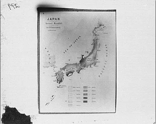
Map of Japan by Genthe
Genthe · 1908-01-01
Library of Congress · photo, print, drawing
![[Maps of the world], 1851-01-01 by Unknown artist](/api/artwork-image/loc-item-95522154/unknown-artist-maps-of-the-world-1851-01-01-library-of-congress.webp?q=72&w=2048)
[Maps of the world], 1851-01-01
Unknown artist · 1851-01-01
Library of Congress · photo, print, drawing

Picturing America: The Golden Age of Pictorial Maps by Library of Congress
Library of Congress · 2017
Library of Congress · film, video

遊戲教育征清雙六.
Unknown artist · 1894
Princeton Digital PUL · 1 sheet : black and red ; 78…
![Map of the United States and Texas boundary line and adjacent territory determined & surveyed in 1857-8-9-60 by J.H. Clark, U.S. Commissioner, &c &c. under the direction of the Departement [sic] of the Interior by Weyss, J. E.](/api/artwork-image/dpul-4t64gq01t/weyss-j-e-map-of-the-united-states-and-texas-boundary-line-and-adjacent-territory-determined-surveyed-in-1857-8-9-60-by-.webp?q=72&w=2048)
Map of the United States and Texas boundary line and adjacent territory determined & surveyed in 1857-8-9-60 by J.H. Clark, U.S. Commissioner, &c &c. under the direction of the Departement [sic] of the Interior
Weyss, J. E. · 1902
Princeton Digital PUL · (W 108°00ʹ00ʺ--W 96°20ʹ00ʺ/N 37°15ʹ00ʺ--N 31°00ʹ00ʺ).
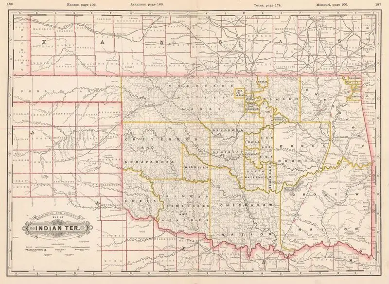
Railroad and county map of Indian Ter
Cram, George Franklin, 1841-1928 · 1888
Princeton Digital PUL · (W 103°00ʹ00ʺ--W 94°25ʹ00ʺ/N 38°14ʹ00ʺ--N 33°30ʹ00ʺ).
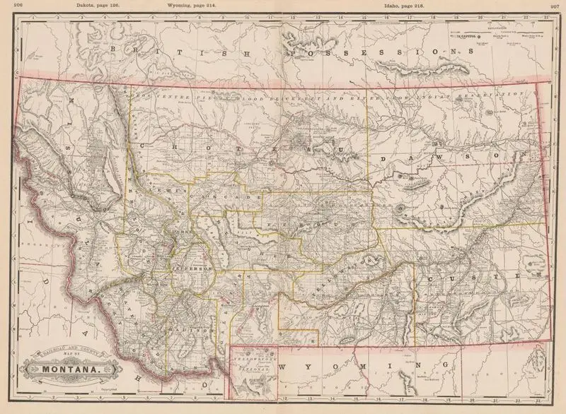
Railroad and county map of Montana
Cram, George Franklin, 1841-1928 · 1888
Princeton Digital PUL · (W 116°10ʹ00ʺ--W 103°45ʹ00ʺ/N 50°15ʹ00ʺ--N 44°21ʹ00ʺ).
![Outline map of Hancock Co., Illinois [map]. by Unknown artist](/api/artwork-image/dpul-js956r140/unknown-artist-outline-map-of-hancock-co-illinois-map-princeton-digital-pul.webp?q=72&w=2048)
Outline map of Hancock Co., Illinois [map].
Unknown artist · 1887
Princeton Digital PUL · 1 map ; 32 x 31 cm.
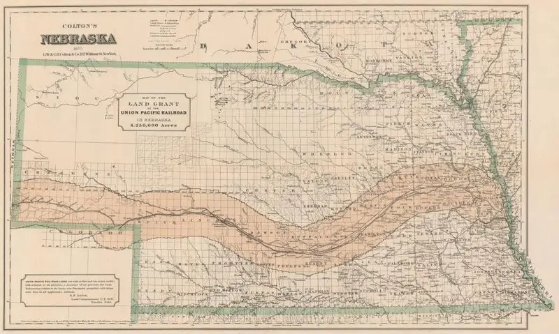
Colton's Nebraska : map of the land grant of the Union Pacific Railroad in Nebraska
Colton, G. Woolworth (George Woolworth), 1827-1901 · 1877
Princeton Digital PUL · (W 104°05ʹ00ʺ--W 95°14ʹ00ʺ/N 43°31ʹ00ʺ--N 39°45ʹ00ʺ).
![Map illustrating the system of parcs, the domestic relations of the Great Plains, the North American Andes, and the Pacific maratime [i.e. maritime] front by Unknown artist](/api/artwork-image/dpul-vq27zq776/unknown-artist-map-illustrating-the-system-of-parcs-the-domestic-relations-of-the-great-plains-the-north-american-andes-.webp?q=72&w=2048)
Map illustrating the system of parcs, the domestic relations of the Great Plains, the North American Andes, and the Pacific maratime [i.e. maritime] front
Unknown artist · 1874
Princeton Digital PUL · (W 129°00ʹ00ʺ--W 83°00ʹ00ʺ/N 50°30ʹ00ʺ--N 22°00ʹ00ʺ).
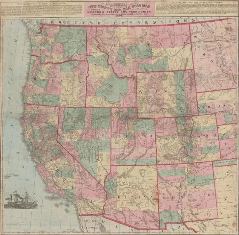
Watsons new county and railroad map of the western states and territories
Watson, Gaylord · 1871
Princeton Digital PUL · (W 128°00ʹ00ʺ--W 97°15ʹ00ʺ/N 50°00ʹ00ʺ--N 30°30ʹ00ʺ).
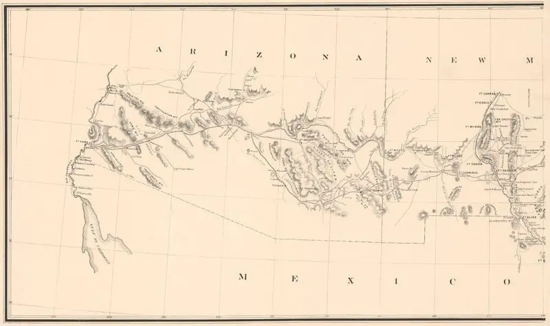
Outline map showing a new route from Texas to Fort Yuma, California : for cattle droves and trains en route to California. Prepared under direction from Brevet Major General J.J. Reynolds, Commdg. Department of Texas
Pressler, Chas. W. · 1870
Princeton Digital PUL · 1 map ; 36 x 126 cm.
![Colton's map of the states and territories west of the Mississippi River to the Pacific Ocean [map] : showing the overland routes, projected rail road lines, &c. / by G.W. & C.G. Colton by G.W. & C.B. Colton & Co.](/api/artwork-image/dpul-2v23w372r/g-w-c-b-colton-co-colton-s-map-of-the-states-and-territories-west-of-the-mississippi-river-to-the-pacific-ocean-map-show.webp?q=72&w=2048)
Colton's map of the states and territories west of the Mississippi River to the Pacific Ocean [map] : showing the overland routes, projected rail road lines, &c. / by G.W. & C.G. Colton
G.W. & C.B. Colton & Co. · 1869
Princeton Digital PUL · 1 map : col. ; on sheet 75…
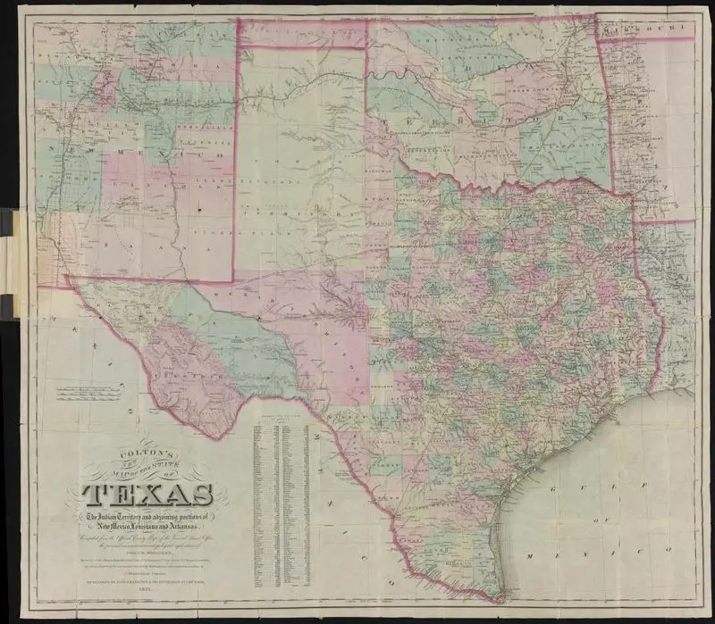
Colton's new map of the State of Texas, compiled from J. De Cordova's large map
Colton, G. Woolworth (George Woolworth), 1827-1901 · 1864
Princeton Digital PUL · 1 map : col. ; 41 x 62…
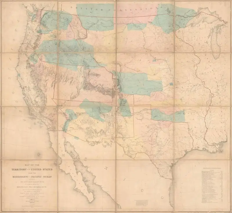
Map of the territory of the United States from the Mississippi to the Pacific Ocean; ordered by Jeff'n Davis, Secretary of War to accompany the reports of the explorations for a railroad route
Warren, G. K. (Gouverneur Kemble), 1830-1882 · 1857
Princeton Digital PUL · 1 map hand col. 107 x 117 cm.
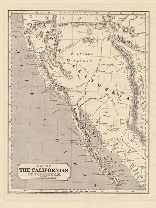
Map of the Californias
Farnham, Thomas Jefferson, 1804-1848 · 1845
Princeton Digital PUL · (W 128°00ʹ00ʺ--W 104°00ʹ00ʺ/N 43°00ʹ00ʺ--N 22°30ʹ00ʺ).
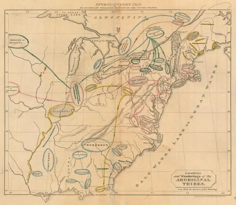
Introductory map : to accompany Willards History of the United States
Willard · 1829
Princeton Digital PUL · (W 95°00ʹ00ʺ--W 64°05ʹ00ʺ/N 49°18ʹ00ʺ--N 28°45ʹ00ʺ).
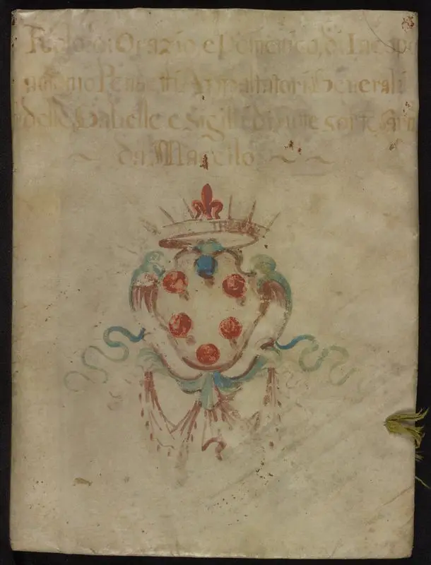
Portolan atlas
Unknown artist · 1575
Princeton Digital PUL · 8 leaves : parchment, illustrations, maps ; 205…
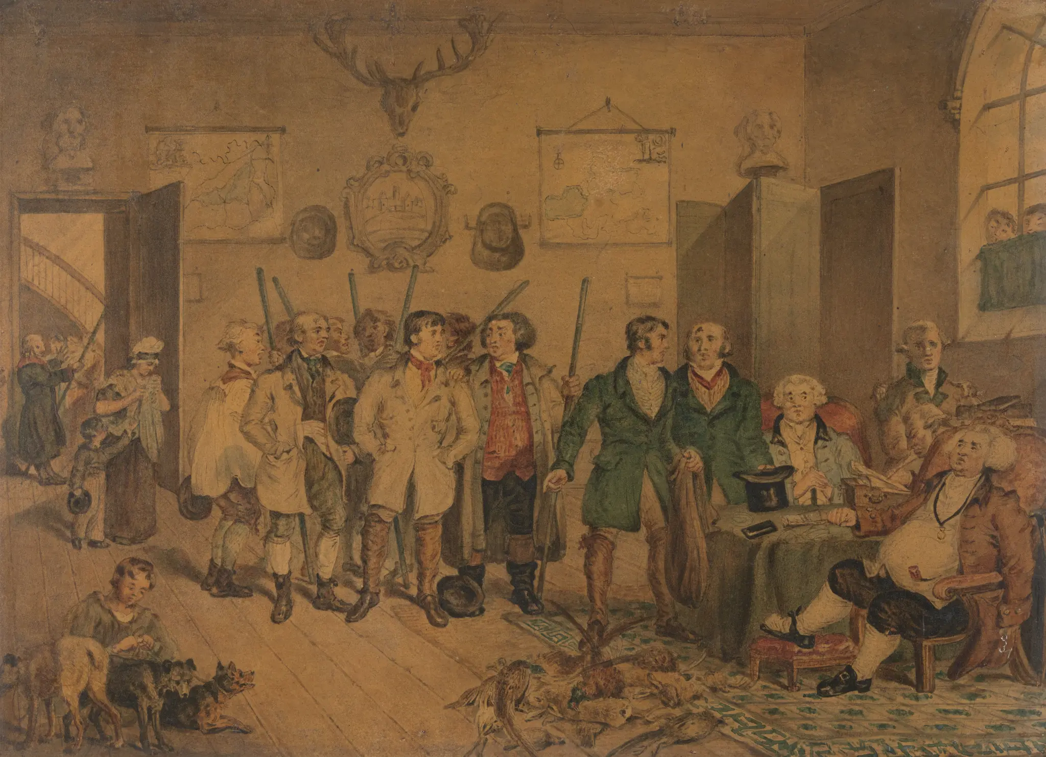
"The Poacher's Progress:" Poachers Before the Magistrates
C. Blake, active 1825–1826 · undated
Yale Center for British Art · Graphite, watercolor, and varnish on very…

Map of eastern Kansas by E.B. Whitman & A.D. Searl
Whitman, E. B. · 1853
Princeton Digital PUL · map. 68 x 53 cm. fold to 16…